
 Italiano
IDRAN experts have just concluded the training course on the use of GIS software for flood risk management plans that was requested by the Autorità di bacino del fiume Tevere. The course, that involved the technicians and managers of the river basin authority for 4 months for a total of 80 hours, guided the participants through theoretical…
Continue Reading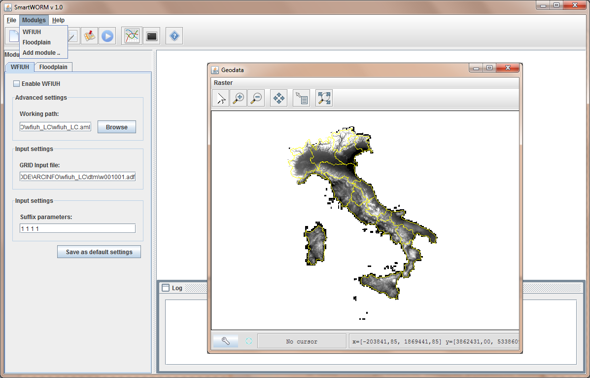
SMART-CUDE: an IT platform for the river-road intersections design on large regions
SMART-Water Optimal Risk Management (SMART-WORM) is an IT platform, built within a custom Geographic Information System (GIS), for the development, application and deployment of optimal mitigation works for water-driven natural disaster risk reduction and management activities under severe climatic and hydrologic conditions with specific regard to smart land/urban planning projects from the global to the local scale.
Continue ReadingPRO and BASIC, FLO-2D’s new versions
The new FLO-2D has finally arrived to Europe. The world wide famous software for the simulation of channel flow, unconfined overland flow and street flow over complex topography presents the new version with two acquisition possibilities that will increase even more the user target. FLO-2D Basic is the new free model offered by FLO-2D, a…
Continue Reading