
 Italiano
Smart CUlvert DEployment
SMART-CUDE is an application of the SMART-WORM IT platform for performing technical and economical design of culverts at the large scale.
It takes advantage of the advanced GIS, Remote Sensing tools and data of SMART WORM for performing hydrogeomorphic analyses on large regions through an automatized processing chain for identifying flood prone areas and the most critical river-road intersections.
SMART-CUDE is perfectly suited for flood risk assessment and protection of major river tributaries and ephemeral stream channels.

KEY FEATURES
• GIS Interface and data
• Easy visualization and navigation of flood prone areas
• Hydraulic engineering design at the large scale
• Decision Support System for urban planning
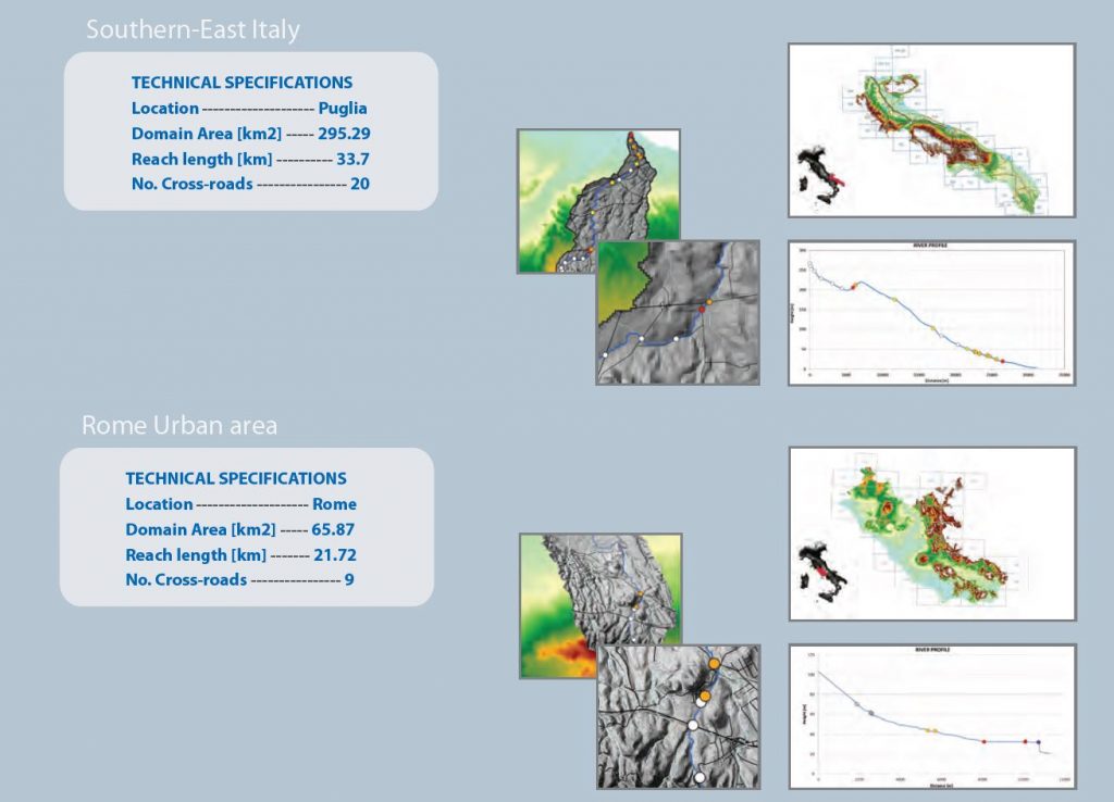
CASE STUDIES
SMART-CUDE allows to perform smart quantitative and qualitative analysis of the number and type of culverts needed for flood risk mitigation at the country scale. A culvert automated classification is performed using the CUDE INDEX that identifies the criticality of each specific road/river intersection. The culverts are positioned and pre-designed for the most critical road segments within the river floodplain.
OUTCOMES
OUTCOMES of the SMART-CUDE Application
- Optimal positioning for increased efficiency of culverts
-
30-60% flood risk reduction for road infrastructures
-
15-30% decrease of the estimated budget for flood risk mitigation at region scale
Illustrative material in the brochure