
 Italiano
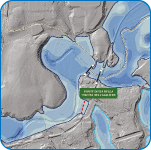
The Hydrogeological Asset Plans are territorial planning tools aimed at managing and reducing the risk of floods and landslides.
The Hydrogeological Asset Plans perimeter and identify qualitatively and quantitatively the elements and areas at risk in order to sustainably manage socio-economic and industrial development activities.
The preparation of The Hydrogeological Asset Plans is based essentially on the geometric characterization of the elements of the territory (Topography), on definition and numerical verification of river basin response to heavy rainfall (Hydrology) and on the evalutation of the effects induced by such hydrological forces in the valley areas of the water courses (Hydraulic/flood) and in the slopes (geomorphology/landslides and debris castings).
IDRAN uses tools and data for topography (e.g. DTM and DSM LIDAR, VAV and Laser Scanner) to hydrological/hydraulic modeling (e.g. commercial and experimental calculation codes for inflow/outflow simulation, 1D and 2D hydrodynamic propagation algorithms) and for GIS mapping of hydraulic and geomorphological risk areas.