
 Italiano
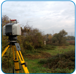 IDRAN, thanks to it multidisciplinary team on the fields of hydrology, hydrogeology, geomorphology, and hydraulic offers an advanced service of organization, management and execution of survey and monitoring campaigns for water resources’ and in projects for hydraulic risk assessment. IDRAN take advantage of state of the art equipments for land monitory and aircrafts with GPS e LiDAR.
In addition to surveys, IDRAN take care of the management of data coming from remote sensing for the monitoring of large areas taking advantage of data from multiple Spatial Agencies.